Understanding and assessing water flows, use and quality is central to the Hazelwood Rehabilitation Project.
ENGIE Hazelwood needs to deliver a rehabilitation outcome which is not only stable but non-polluting, sustainable and safe.
These are both the project’s objectives and formal requirements that ENGIE Hazelwood must comply with, under its Mine Licence and under Victoria’s mining and environmental laws.
ENGIE Hazelwood is proposing the creation of a pit lake filled to +45mRL (or 45m above sea level.)
The project is proposing to use a range of available water resources including groundwater, surface water and potentially some excess flood flows from the Morwell River.
Alternative water sources and any potential impacts to water resources and waterways and catchments in the Latrobe Valley will be considered in the preparation of the EES.

Proposed water sources
Water sources proposed to fill the pit lake are:
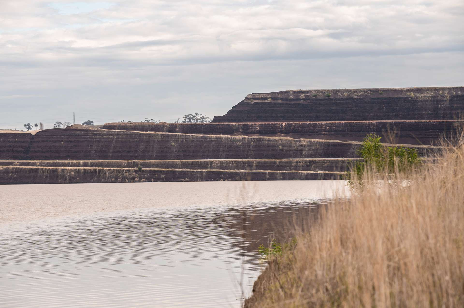
groundwater, which is already collecting within the mine void
water from the Moondarra Reservoir which ENGIE purchases from Gippsland Water
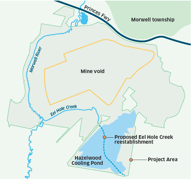
water from the Hazelwood Cooling Pond
The lake filling process is expected to take 10 to 15 years. The filling duration will be influenced by the availability of water – in periods of high rainfall it may be possible to speed up filling whereas dry conditions would require filling to slow down to preserve water for other important uses in the Latrobe River catchment and the environment.
Water courses around the mine
Two options for the pit lake will be assessed in the EES:
An unconnected lake, which does not connect with any other waterways.
A connected lake, allowing floodwaters from the Morwell River in periods of high rainfall to flow into and out of the lake.
The Morwell River will stay on its current course with regular levels continuing to run through the existing river system. During flood events, floodwater from the Morwell River may be diverted into the mine pit.
Eel Hole Creek currently flows through the Hazelwood Cooling Pond. The Hazelwood Rehabilitation Project proposes to transport water from the Hazelwood Cooling Pond into the pit lake and reinstate Eel Hole Creek back to its natural alignment.

Frequently Asked Questions
The EES will include a feasibility assessment of options and alternatives for stabilising and rehabilitating the large Hazelwood mine void, including other options for filling the mine, and alternative water sources for creating the proposed lake.
Extensive previous technical assessments have been undertaken involving independent specialist advice, though the 2015-2016 Hazelwood Mine Fire Inquiry, the Latrobe Valley Regional Rehabilitation Strategy (LVRRS), the Integrated Mines Research Group and ENGIE Hazelwood’s
own studies program.
Informed by this work, ENGIE Hazelwood considers a full pit lake to be the most effective and lowest risk method for achieving a long- term safe, stable, sustainable and non-polluting landform
There is already water in the Hazelwood mine void. Some of the water is flood flows from the Morwell River Flood Diversion, which operated temporarily under emergency approvals to take flood waters from the Morwell River and enable batter repairs at the Yallourn Mine. There is also water in the mine void from rainfall and water used for dust and fire suppression
One of the other sources of water already in the mine is groundwater. Now that groundwater does not need to be pumped away to keep the void dry for coal mining, it is being allowed into the mine through a controlled process
If the groundwater pumps were simply turned off and the site was left, over decades the mine void would fill with water, to well over half full and potentially up to the level being proposed for the full pit lake. However, this inflow of groundwater, if uncontrolled, would likely result in floor heave and instability of the mine walls. Any such event would likely affect the nearby Princes Freeway, southern part of the Morwell township, and limit land use in the vicinity of the mine, an impact which is clearly unacceptable. The full lake landform proposed by ENGIE is intended to permanently and passively stabilise the mine void, and eliminate these risks.
The EES will include an assessment of the proposed water resource use in different climate scenarios and the project’s potential impacts on downstream waterways and ecosystems, including the Gippsland Lakes Ramsar site. The Climate Change technical study will consider credible climate change scenarios that could impact:
projected water availability
potential downstream impacts to the Latrobe River catchment from continued water resource use
fire risk due to changing climate
Water fill during dry periods could require scaling back of fill from sources which are more susceptible to climatic influences.
This proposed variable lake filling approach would ensure that the needs of other users and waterways can be balanced and prioritised, particularly during drier periods.

